
Walk a Peekskill Street Record by Record
Ownership and occupancy are different questions. A Peekskill address first produces a parcel record, not a household list. The City property-card instructions and assessment rolls can identify the situs address, assessed owner, mailing address, Section-Block-Lot identifier, and deed book or page fields. From there, the same parcel can be checked in the county map and land-record index. A historical directory may offer an address-to-name clue for an earlier period, but it needs a date check against deeds, maps, and census material.
- Enter the complete address in the City property-card workflow, or use the owner name or SBL when either is already known. Keep the situs and tax-mailing addresses as separate notes.
- Confirm the parcel in the Westchester Municipal Tax Parcel Viewer. Note the road, parcel number, map context, and adjoining polygons before using that information in another source.
- Use the identified owner and legal description in Westchester Records Online, known as WRO. The purchase deed can name the transfer parties and point to an earlier instrument.
- Use the New York voter lookup only for an individual identity search with its required fields. A street-by-street voter roster is not an ordinary public browse tool.
- For an earlier period, test the address in a reverse or criss-cross directory if a repository has the relevant volume, then compare it with the closest released census year.
That order prevents a common error: treating a tax owner, an old directory entry, and a current resident as if they were automatically the same person. The parcel and the record date are the anchors.
Peekskill Parcel Search Start
The City of Peekskill directs address researchers to its property-card and tax-map workflow. It accepts a street address, Section-Block-Lot, or owner name. First accept the Westchester County GIS disclaimer. Then verify that the map displays the red “Peekskill” label, make the parcel information balloon fully visible, and use the blue property-card PDF link. Those steps matter because municipal context is part of identifying the right parcel.
The city cautions that viewer tax data dates from 2010 and the scanned cards are from about 2006. They are useful historic snapshots, not proof of current ownership. Use a current city assessor or RPS check and the recorded deed trail for a current question. Assessment-roll rows can also provide the property address, owner mailing address, class, exemption, assessment, district, and deed book or page reference.
Peekskill’s property-card instructions show the address, owner, and SBL path into the parcel viewer.
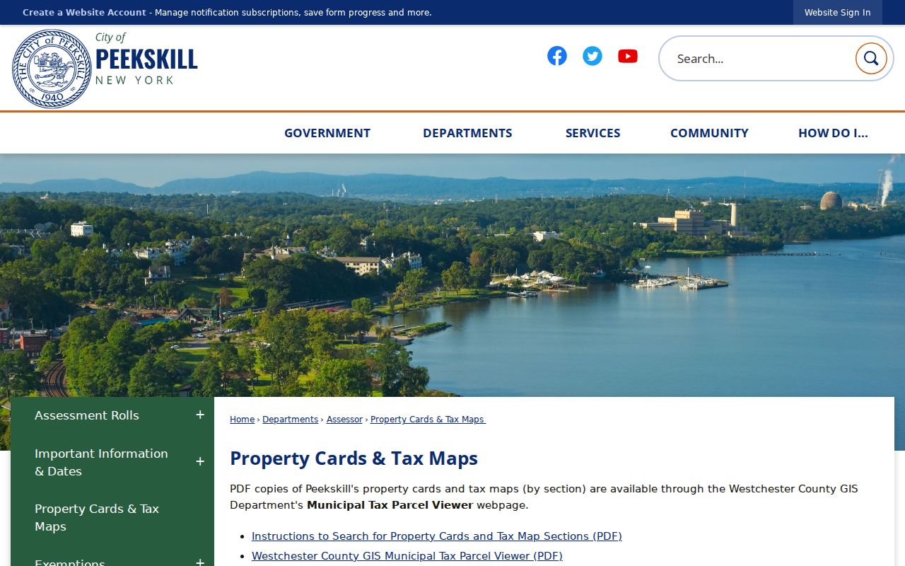
The screen is most useful as a confirmation checkpoint. It shows why the municipality label, parcel balloon, and blue card link should all be verified before copying a parcel detail into an address search.
| Field or control | How it helps a street search |
|---|---|
| Street address | Locates the situs parcel. |
| Section/Block/Lot | Supplies the exact tax-parcel identity. |
| Owner name | Provides an alternative assessment search key. |
| Disclaimer acceptance | Opens the tax-parcel map. |
| Map click or drag | Expands the parcel balloon and its details. |
| Blue property-card link | Opens the historic PDF card after parcel selection. |
| Identify or Query | Reads county GIS parcel attributes and nearby parcels. |
| Road and parcel labels | Helps browse a defined street segment. |
Map a Peekskill Street by Parcel
The Westchester Municipal Tax Parcel Viewer is the practical map layer for moving along a Peekskill block. The county service documents Peekskill parcels at layer 429 and supports map browsing, Identify, Query, Find, legend, and export functions. Locate one address, select the parcel, record its SBL or legal fields, then pan to the next polygon. The assessment roll is arranged by SBL rather than as a simple alphabetical street list, so the map supplies the bridge between the road name and the tax record.
County parcel boundaries are approximate and intended for planning or general information. They are not a survey and are not the definitive local tax map. For a tax-map question, compare the county view with the City tax-map PDFs and ask the assessor about an uncertain boundary. A defined group of parcels is a sound use of Query or export; an invented radius search is not needed.
Westchester’s parcel viewer is the county map entry point for this portion of Peekskill address research.
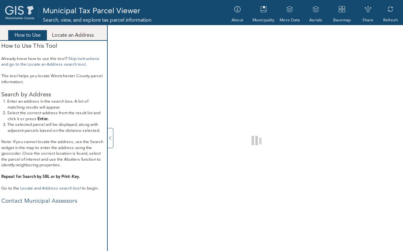
Use the parcel viewer to compare shapes, roads, and labels, then return to the assessor, City map, or WRO for the record that carries the fact being checked.
Peekskill Records Usable by Street
Several Peekskill and Westchester sources use an address, parcel, or legal description, but each answers a different question. A property roll is assessment evidence. A map is parcel context. A deed index follows recorded transfers. Building and Code records may date work when the city releases them. Keeping the source labels visible helps prevent an address-search result from becoming a claim the record cannot support.
| Address record set | What it can establish | Access route |
|---|---|---|
| Assessment roll | Assessed owner, situs, mailing address, SBL, class, assessment, exemptions, and districts | Peekskill assessment-roll PDFs |
| Property card and tax map | Historic card and parcel details | City workflow after disclaimer acceptance |
| County GIS | Roads, parcel boundaries, labels, and planning context | Public map, with approximate-boundary warning |
| Deed and mortgage index | Grantor, grantee, dates, book or page, and legal trail | WRO, then Archives for older work |
| Voter record channel | Individual registration or poll-site match under New York rules | State voter lookup or an elections-purpose file request |
| Building or Code record | Released work, inspection, or code-history material | Address, SBL, and date-range request |
Property and deed records connect most reliably through SBL and legal description. A street name can shift in spelling, postal label, or number, while the parcel identifier and the recorded description give more stable points to compare.
Note: An owner mailing address can be a tax-contact address and is not, by itself, evidence that the owner lives at the property.
Westchester Deeds Along a Peekskill Street
WRO centralizes Land, Legal, Maps, and Trades searching and advertises an index from 18th-century deeds through current records. An index search can begin free, but image and report viewing requires an account and paid subscription. The public session did not expose WRO’s live authenticated field screen, so its exact current grantor and grantee labels and image fees should be checked in the portal rather than assumed.
Start from the assessed owner and SBL, then search the owner with the parcel’s legal description, municipality, dates, spouse names, and book or page details where available. Pull the purchase deed and identify the seller. The seller’s earlier acquisition can lead back another step. If the online record or image trail ends, County Archives deed indexes and books fill the older path. Archives records include deed grantor and grantee work from the 1680s through 1907, with deed books reaching about 1903.
The Clerk’s land-record counter is at 111 Dr. Martin Luther King Jr. Boulevard in White Plains, with stated weekday office hours of 8:30 to 4:30 and main phone 914-995-3080. For historical work, the Westchester Archives research-by-mail service can search documented record groups after required payment, while reading-room or reference access may be a better fit for a longer chain.
Peekskill Voter Checks Have Narrow Rules
The New York voter lookup is an individual search, not a directory of everyone on a street. It requires county, last name, first name, date of birth, and ZIP code. Select Westchester County and use the result only as the service presents it, such as a registration or poll-site match. It should not be described as a full current-address roster.
New York treats the full voter file differently. Election Law §3-103(5) limits access to an elections purpose, and the requester must certify that purpose through the applicable process. Confidential registration records and protected addresses are excluded. The public VEDA layer is aggregated and non-personal, so it does not create an anonymous block-browse alternative.
For a valid individual confirmation, compare the returned record with independent dated information such as the parcel, deed, or directory entry. A nonmatch or inactive status does not prove that someone never lived on the street.
Peekskill Street Terms That Prevent Mix-Ups
Address work is clearer when the label attached to each address is retained. A postal ZIP, tax mailing address, physical situs, and legal description can differ in the same Peekskill file. Postal geography adds another caution: ZIP 10566 reaches Peekskill and portions of Cortlandt, while 10567 is associated with Cortlandt Manor and portions of Cortlandt and Yorktown. A ZIP label is not proof of the city boundary.
- Parcel
- A defined piece of land shown in tax and map systems, usually tied to an SBL identifier.
- Situs address
- The physical property address used by the assessment roll, distinct from a tax mailing address.
- Plat
- A mapped subdivision or lot plan that helps connect a recorded lot or block to the ground.
- Criss-cross directory
- A reverse directory arranged to help move from an address or street to a listed name, when a relevant volume exists.
For an older address, use the SBL, map sheet, adjoining owners, lot dimensions, and recorded description alongside the street number. These details are especially helpful when a postal or municipal label varies across records.
Peekskill Building Records by Address
No public Peekskill permit or Code portal was located in the research. The documented fallback is a focused request to Building and Code that gives the address or SBL and a date range, rather than an open-ended request for a person. Released material may identify an application date, work type, owner or applicant, inspection, or status, depending on the record series and applicable privacy rules.
Call Peekskill Building and Code at 914-734-4140 to ask for the correct request route. Municipal records may also be requested through the City Clerk’s FOIL channel. New York FOIL is Public Officers Law Article 6, §§84-90, but access can still be limited by a separate confidentiality rule or privacy redaction.
Do not treat an address appearing in an accident report, permit, or code record as a directory of people. It is an event or property-record clue with its own date and purpose.
Historic Peekskill Street Clues
When an address predates the current property card, use sources built for the period in question. The New York State Library holds selected Peekskill directory runs from 1875 through the 1940s, with further reel runs to 1959 and documented gaps. A reverse or criss-cross volume can supply an address clue, but the exact locally held reverse-directory volumes were not cataloged publicly. The historical collections themselves are described in the Peekskill Directory Book.
For buildings, the Westchester Archives has a 1900 Peekskill/Verplanck/Buchanan Sanborn microfilm set, and the Library of Congress provides a July 1911 Peekskill set of 37 sheets. These maps show building footprints, use, construction material, fire features, and street or house numbers. They are building evidence, not a list of residents.
Peekskill’s zoning and map page links the City map context with the county GIS route.
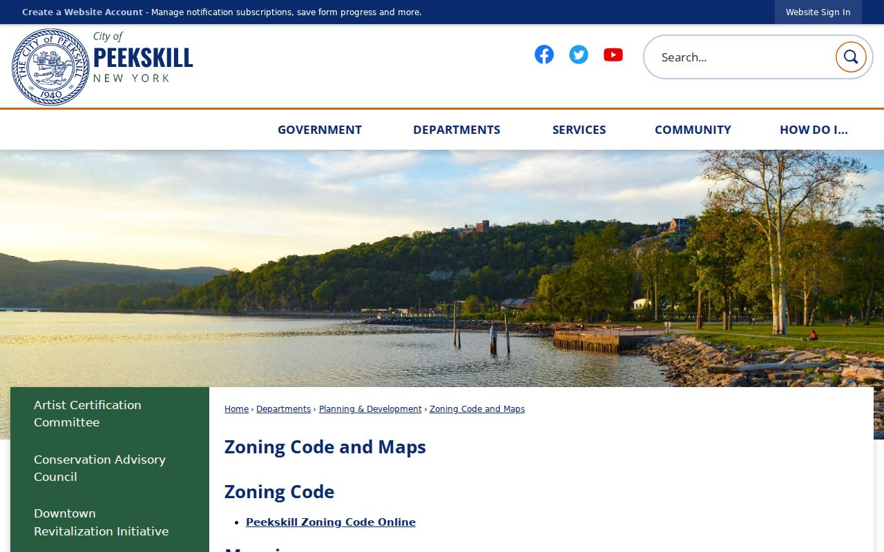
Use the City map as a location and district aid, then return to the particular roll, deed, directory, or historic map needed to support the date-specific conclusion.
Peekskill Map 33.11 Name Clues
City Map 33.11, dated May 1, 2025, can help when a street number alone does not reach the right property. It records parcel boundaries, roads, lot numbers, common-owner areas, and development names such as Woods III, Villa at Woods, Pines, Orchards, Lofts, Hillside, and Fields at Chapel Hill. A development name may be a useful alternate search term for a condominium or common-owner tract.
That vocabulary is a locator, not a claim about who is present at a property. Pair it with the SBL and a dated tax, deed, or directory record. The map also reflects the way land descriptions can outlast a changing street-number format.
Note: The exact history of Peekskill street renumbering and renaming was not located, so suspected changes should be checked with maps and sequential directories.
Limits on Peekskill Street Searches
These records cannot create a complete household roster. Property records identify an assessed owner and tax fields, not every person at an address. Deeds document recorded transactions, not necessarily a current physical presence. Historical directories are dated publications with gaps. DMV and utility customer information are not ordinary public address sources, and confidential voter or Address Confidentiality Program records are not routes to a protected location.
Records may also contain redactions under FOIL privacy rules or another controlling statute. Preserve only the minimum details needed for a personal, lawful property, family-history, civic, or safety question. Verify a decision-critical fact with the custodian that holds the record.
Lawful use. Peekskill street and address records support narrow, personal research. Do not use them to monitor, threaten, repeatedly contact, or harass any person.